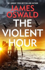
On the Trail of the Violent Hour with James Oswald
On the Trail of the Violent Hour with James Oswald
Sometimes an author talks about the locations in their book, but sometimes the author takes us around all the nooks and crannies of that place so you experience it through very different eyes……………
Cutter’s Vennel/Innocent Railway
You won’t find Cutter’s Vennel on any map of the city, because I made it up. In the book it’s a modern alley between two industrial units, following the old route from an abattoir down to a loading platform alongside the Innocent Railway. You will find that on maps of the city, and it has a long and interesting history. Originally built to transport coal from the mines of Millerhill, Sheriffhall and Dalkieth, it gets its name from the fact that unlike many contemporary railways running new-fangled steam engines, coal wagons were drawn along the rails mainly by horse.
Map of locations in The Violent Hour
Gullane Point and Aberlady Bay
Ten miles east of Edinburgh, along the south coast of the Firth of Forth, Aberlady Bay is one of Scotland’s oldest nature reserves and a fine place for bird watching.
Further round the point, Gullane Beach is a beautiful expanse of sandy beach, backed by rolling dunes. As far as I am aware, there is no Viking longship burial site there.
Map of locations in The Violent Hour
Lochinver
Somewhat further afield, the village of Lochinver lies at the head of the sea loch of the same name. About forty miles south of Cape Wrath, it is in the heart of the Assynt region of Sutherland and is a major landing port for landing fish caught in the north Atlantic.
Old Leith
One of the murders in the book takes place in Leith, and while I’m not absolutely specific about the location, I had in mind one of the streets running east from the Shore, like Broad Wynd, where modern apartment buildings have been shoehorned in between older tenements and warehouses.
Map of locations in The Violent Hour
Edinburgh University Archaeology Dept.
Janie Harrison visits Professor Hattie Turner at the University of Edinburgh School of History, Classics and Archaeology for information about an ancient relic that may be relevant to her investigations. I’ve cheated a little, and put the professor’s office in one of the grand terraced buildings in Buccleuch Place. The actual school, however, is housed in the old medical buildings across George Square from there, in Teviot Place. Artistic licence, innit.
Map of locations in The Violent Hour
Brunstane Burn
Rising on the northern slopes of the Pentland Hills at Swanston, this watercourse is in places known as Burdiehouse Burn or Niddrie Burn. It passes through several South Edinburgh districts on its way to the Firth of Forth at Eastfield. While some of the burn still cleaves to the image that Scots word implies, a lot of it is fast-moving man-made concrete culvert or channel. In places it disappears underground entirely. This is something I have used in the book to hide nefarious deeds.
Map of locations in The Violent Hour
Musselburgh Beach
The Brunstane Burn flows into the waters of the Firth of Forth at the western end of Musselburgh Beach. It is here that the unconscious body of a naked man is found at the low tide line. Something which when brought to Tony McLean’s attention he cannot leave uninvestigated.
Thanks James!
Always a pleasure to have you and your murder victims on The BookTrail!
BookTrail Boarding Pass: The Violent Hour
Twitter: @SirBenfro