Under a Spanish Sky with T A Williams
Under a Spanish Sky
The book is a dual timeline (modern day and medieval) tale of two couples making their way along the famous “Camino”. This is the old pilgrimage route linking the rest of Europe with Santiago de Compostela in north west Spain.
Location Map of Under a Spanish Sky

Location Map of Under a Spanish Sky
I have now had over 40 books published, and I make a point of only writing about places I have visited. I am not a religious person, but I have a keen sense of history and I had known for many years that this was something I wanted to do. The traditional way is on foot, the easy way is by car. I opted to do it on a bike – 1900 km in three weeks (and I lost 7 kg in the process – if that isn’t devotion to research, I don’t know what is).
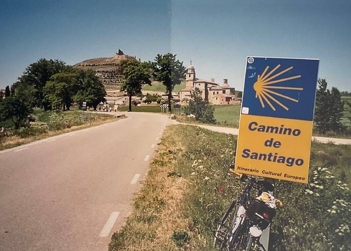
Camino de Santiago (c) T A Williams
A brief historical note:
Location Map of Under a Spanish Sky
To the early Christians, pilgrimages were of vast importance. So important, in fact, that completion of a pilgrimage to one of the main Christian sites could bring full remission of sins. Quite an inducement! The most important sites were Jerusalem and Rome, however in the Dark Ages both became dangerous and difficult to reach. Then coincidentally (cynics might say suspiciously) in 813AD the tomb of Saint James the Apostle was discovered in Santiago de Compostela in Northwest Spain and the flow of pilgrims picked up again unimpeded.
Camino de Santiago (c) T A Williams
Location Map of Under a Spanish Sky
The route followed by the pilgrims in Under a Spanish Sky begins in France, just north of the Pyrenees. From there they climb over the mountains before dropping down into Spain. The terrain changes rapidly from the high mountains with snow covered peaks to the vast, gently undulating flatlands of northern Spain. For somebody used to the fields and hedges of England, Spain seems so vast with its uninterrupted landscape and never-ending horizons.
Pamplona
Location Map of Under a Spanish Sky
The route runs through Pamplona (famous for the running of the bulls) and then on to Puente La Reina, a major meeting point of different pilgrim routes. The old bridge is still there and the flow of pilgrims increases steadily from then on.
Logroño
Location Map of Under a Spanish Sky
The route continues through Estella and Los Arcos to Logroño, another important waystage with a vital bridge crossing the river. From there the Camino goes on to Santo Domingo de la Calzada, another important point because in medieval days, it was the site of a pilgrims’ hospital. That has now been transformed into a marvellous luxury parador hotel and, because this was a research trip after all, I allowed myself a night of luxury and relaxation there.
Santo Domingo de la Calzada
Location Map of Under a Spanish Sky
On the subject of accommodation, then as now, there is a network of pilgrim hostels, mostly sponsored by the Roman Catholic Church. In return for a modest charge, these places provide a bunk for the night and a chance to rest and recuperate. Over the past few years the Camino has seen an upsurge in popularity and, as a result, these hostels are now often oversubscribed, so my advice would be if you have the money, leave the hostels to those who genuinely need the charity and book yourself into one of the numerous one or two star hotels along the route. They won’t break the bank and I didn’t have a bad experience in any of them.
O Cebreiro
Location Map of Under a Spanish Sky
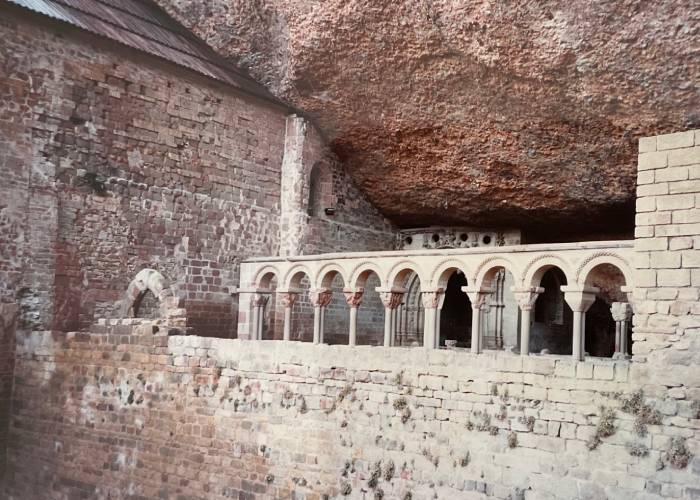
The Camino then begins to climb again via, crossing mountain passes like O Cebreiro, higher than those of the Pyrenees, before finally dropping down into Santiago itself. This is a magnificent city with an almost palpable sense of history and, if you’ve completed the whole thing, I suggest you do what I did and splurge on a night at the five star Hostal de los Reyes Catholicos.
So, if you enjoy reading Under a Spanish Sky, you have three weeks to spare and a bike, you know what to do…
BookTrail Boarding Pass: Under a Spanish Sky
Insta : @tawilliamsbooks/